
Clinton Township ZIP Code Coverage
Three standard residential ZIP codes serve Clinton Township: 48035, 48036, and 48038. They are postal delivery areas, not Township districts. Official Township material provides useful local reference points for each, but an exact street still needs a USPS check and parcel confirmation. The distinction matters because the Township's outline is irregular around Mount Clemens and Fraser, and nearby municipal, school, and service boundaries do not always follow a mailing label.
| ZIP code | Verified local references | Postal reading | Address-check note |
|---|---|---|---|
| 48035 | Southern and eastern address areas; Joy Park, Prince Drewry Park, and Normandy Park examples | USPS delivery geography for Clinton Township | Not a municipal boundary; verify the exact street address. |
| 48036 | Central and eastern address areas; Hall Road, Kensington Church, and Reid Park examples | USPS delivery geography for Clinton Township | Some offices use it as a mailing address; it does not define the Township edge. |
| 48038 | Civic Center, northern, and broad interior areas; Budd Park and Victory Church examples | USPS delivery geography for Clinton Township | Often used as a Township mailing default, but it is not the only local ZIP. |
Township survey responses reported 48035, 48036, and 48038, with other entries representing nearby or nonstandard responses. The local research did not identify a Township-specific PO-box-only ZIP, unique institutional ZIP, or documented ZIP realignment. It is more accurate to verify a mailing address than to infer one of those conditions.
Verify Clinton Township ZIP Codes
The USPS ZIP Lookup is the address-level authority for the postal part of a Clinton Township ZIP code search. It supports an address route, a city-and-state route that lists ZIPs, and a ZIP-to-city route. For an address result, the street address is required and a company field is optional. USPS explicitly warns that a ZIP result does not confirm a person or company at that address, so the result should never be used as a resident claim.
| USPS lookup route | What to enter | Useful result |
|---|---|---|
| By address | Street address, city, and state; company is optional | Postal ZIP for the submitted address |
| By city and state | City and state | ZIPs associated with that postal locality |
| Cities by ZIP | ZIP code | Cities recognized for that ZIP |
Use the response as a spelling and delivery check. It does not replace a property record, a municipal boundary check, or evidence about a named individual.
Map Clinton Township ZIP Overlap
Macomb County Mapping and Data Services provides the county GIS program and its Parcel Explorer. In Parcels Experience, search an address or parcel number, browse the map, click a parcel, and turn on ZIP, school-district, flood-zone, natural-feature, and parcel layers. The ZIP layer shows postal geography. The parcel boundary and connected tax data provide the separate property and jurisdiction check.
This comparison matters near Clinton Township's borders with Mount Clemens, Fraser, Sterling Heights, Roseville, St. Clair Shores, Harrison Township, and Macomb Township. The 2024 Master Plan attributes part of the irregular outline to the formation of Mount Clemens and Fraser from historic Township territory. A nearby city name, ZIP, school district, or county service reference may be useful context, but none should override the parcel's situs and municipal record.
The county mapping-services page identifies the GIS source behind this ZIP and parcel comparison.
Use the ZIP layer to see the overlap, then use a selected parcel and its connected tax record to confirm the address relationship.
Search a Clinton Township ZIP
A ZIP code narrows geography but does not produce a general list of residents. The most reliable Clinton Township sequence is address first, parcel second, and then the limited official record that fits the question. GIS supplies a ZIP layer, while the assessor directions support address, name, parcel, sale, and property filters rather than a verified ZIP field. Michigan's voter lookup uses ZIP as an identity field for a verified individual, not as a way to browse everyone in a postal area.
- Submit the precise street address to USPS and save the returned postal ZIP.
- Find the same address in the Parcel Explorer, then compare the ZIP layer with the parcel and municipal context.
- Use the Township's BS&A address or parcel route to inspect the property record. Do not assume the portal has a ZIP filter, because that capability was not verified.
- For an individual who can pass the required identity check, use the Michigan Voter Information Center with the name, birth month, birth year, and ZIP.
- Check nearby ZIPs when the parcel is close to a delivery boundary, then preserve the source date for every result.
Once a ZIP narrows the area to a particular road, use the Clinton Township street directory for the separate parcel, plat, and deed sequence along that street.
Clinton Township ZIP Search Fields
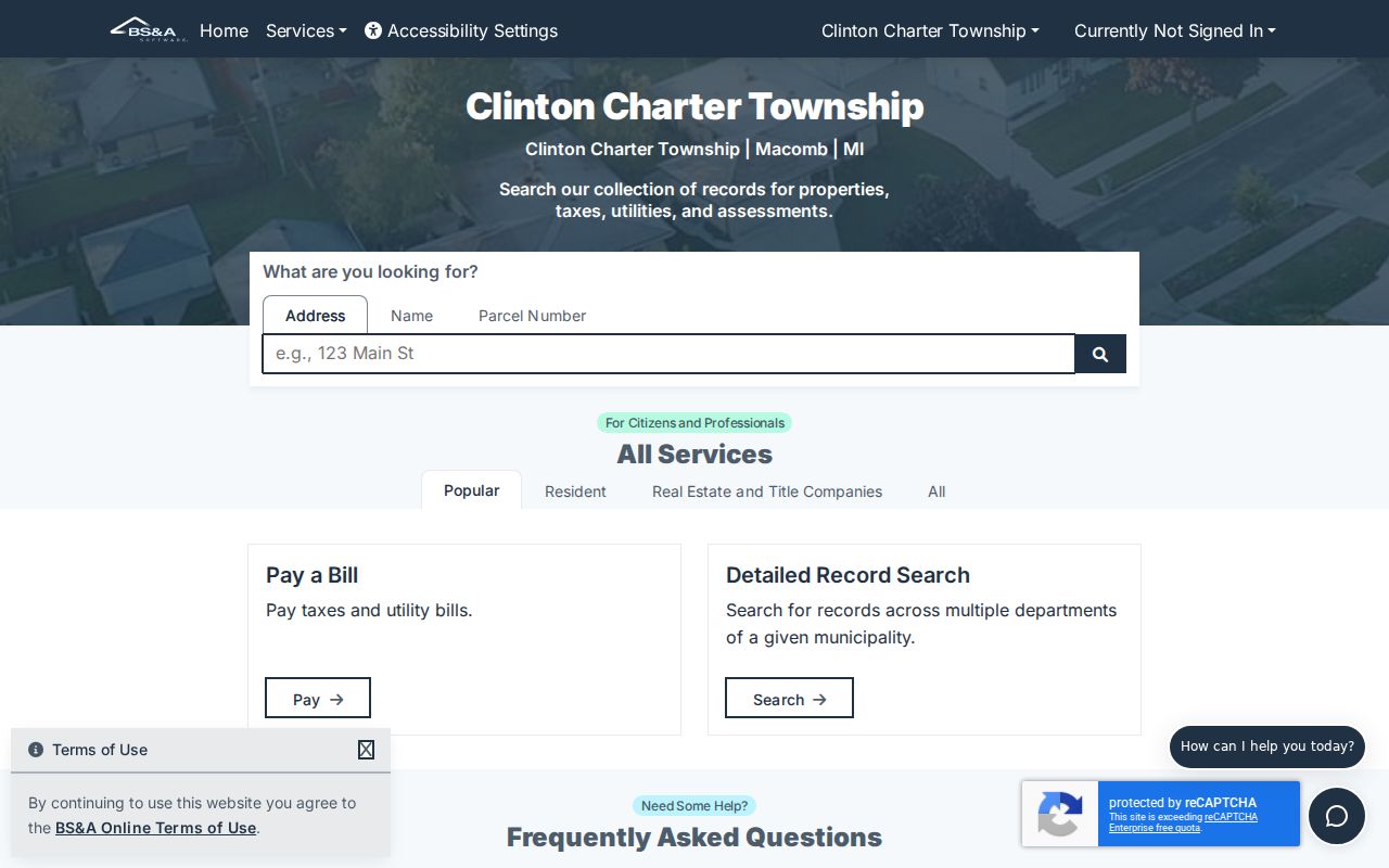
Clinton Township's property-search entry point links to BS&A Online. The published directions list address, owner name, parcel number, sale date, price, grantor or grantee, property class, floor area, year built, and neighborhood. They do not identify a ZIP-code search field. The linked live portal was not available for inspection, so a ZIP code directory should not claim a property-wide ZIP search that the official material did not verify.
The parcel card can still be the bridge after an address has been verified. Expected property and tax information includes the owner, situs and mailing addresses, parcel or tax ID, legal or land information, assessments, taxes, exemptions, building sketch or photos, sale details, year built, floor area, and ECF Neighborhood. Its mailing address is correspondence information, not proof of who is present at the situs.
The BS&A Online portal is the source shown below for the address, name, and parcel entry paths.
After finding a parcel, record the situs, parcel number, legal description, and source date before comparing it with a ZIP layer or recorded transfer.
Read Clinton Township Address Forms
ZIP work becomes clearer when the address terms are separated. The situs address is the physical parcel used by GIS, permits, code complaints, modern property search, and many school or precinct maps. A mailing address receives tax correspondence, deed return instructions, voter mail, and some business filings. The legal description appears in deeds, plats, mortgages, and older records, and it can remain stable while a street label changes. Lot, block, and subdivision language often supplies the connection between a postal address and an older land record.
- ZIP code
- A postal delivery area used to route mail, not a civil-jurisdiction boundary.
- ZIP+4
- An additional postal code that narrows delivery routing beyond the five-digit ZIP.
- PO-box ZIP
- A ZIP used for post-office boxes rather than ordinary street delivery.
- Unique ZIP
- A ZIP assigned to one organization or location for postal handling.
- Carrier route
- A postal delivery sequence within an area, not a property ownership or resident list.
Note: The research found no documented Clinton Township ZIP split or realignment year, so historical postal claims should be checked in USPS and period sources.
Historic Clinton Township ZIP Clues
For older address questions, ZIPs are only one layer and may not be the right starting point. The Mount Clemens Public Library master index covers city directories from 1896 through 1966, and the Clinton-Macomb Public Library and Library of Michigan shelves may help identify a volume that includes the relevant area. Read the address section, street abbreviations, and the publisher's key before drawing a conclusion from a historic listing.
Historic place names can also displace a modern township label. Frederick, Marcellus, Quinn, and Cady's Corner appear in the area's older geography. Plats, Sanborn maps, census enumeration districts, deeds, and legal descriptions can explain whether a street number, rural route, or locality name aligns with a current Clinton Township parcel. A historical directory entry is dated evidence, not confirmation of a present address.
Clinton Township ZIP Edge Checks
Boundary checks deserve extra care in Clinton Township because the civil outline does not follow a simple square grid. The Township's broad geographic references run from 14 Mile Road on the south toward Hall Road on the north, with Union Lake Road and Hayes Road noted as broad east and west limits, but Mount Clemens and Fraser create irregularities. Regional corridors such as Gratiot, Harper, Hall Road, M-59, Groesbeck Highway, I-94, and Romeo Plank can sit close to a different postal, school, precinct, or service boundary.
For an address near an edge, save the USPS answer, then compare it with the GIS parcel boundary, municipality, and any needed school or flood layer. Check 48043, 48026, or 48045 when a nearby delivery area is plausible, but do not substitute a neighboring result for the submitted street address. The approach is especially useful when an older record names Mount Clemens or another historic locality while the current parcel is associated with Clinton Township.
ZIP Code Boundary Limits
Postal boundaries and Clinton Township limits are different systems. ZIP geography can cross parcel, municipal, school, and service lines. Nearby ZIPs include 48043 for Mount Clemens, 48026 for Fraser, and 48045 for Harrison Township, so a boundary address may need a neighboring-ZIP check. The safe sequence is USPS for delivery, GIS for the parcel and layer context, then the applicable Township or county record for jurisdiction.
The Michigan Voter Information Center requires ZIP in its name-based identity route, but it is not a ZIP-wide voter browser. Its result is limited to the person who meets the required fields. A specialized state registry may offer a ZIP or street-radius mode for its own statutory purpose, but that does not make it a general directory. Keep the scope of every record set narrow and do not turn a postal label into a claim about a person or a whole neighborhood.
Boundary check. A Clinton Township ZIP code is useful for mail verification and map context. Confirm the parcel's situs and jurisdiction before relying on it for civic, property, or family-history research.